Where I was going with this is James Wesley Rawles back many moons ago when I was just starting to be able to afford real chunk of property, was using this map.
His dividing line was nothing east of the Mississippi and nothing west of the California ranges. He would flat out say don't live there much less put your BOL there.
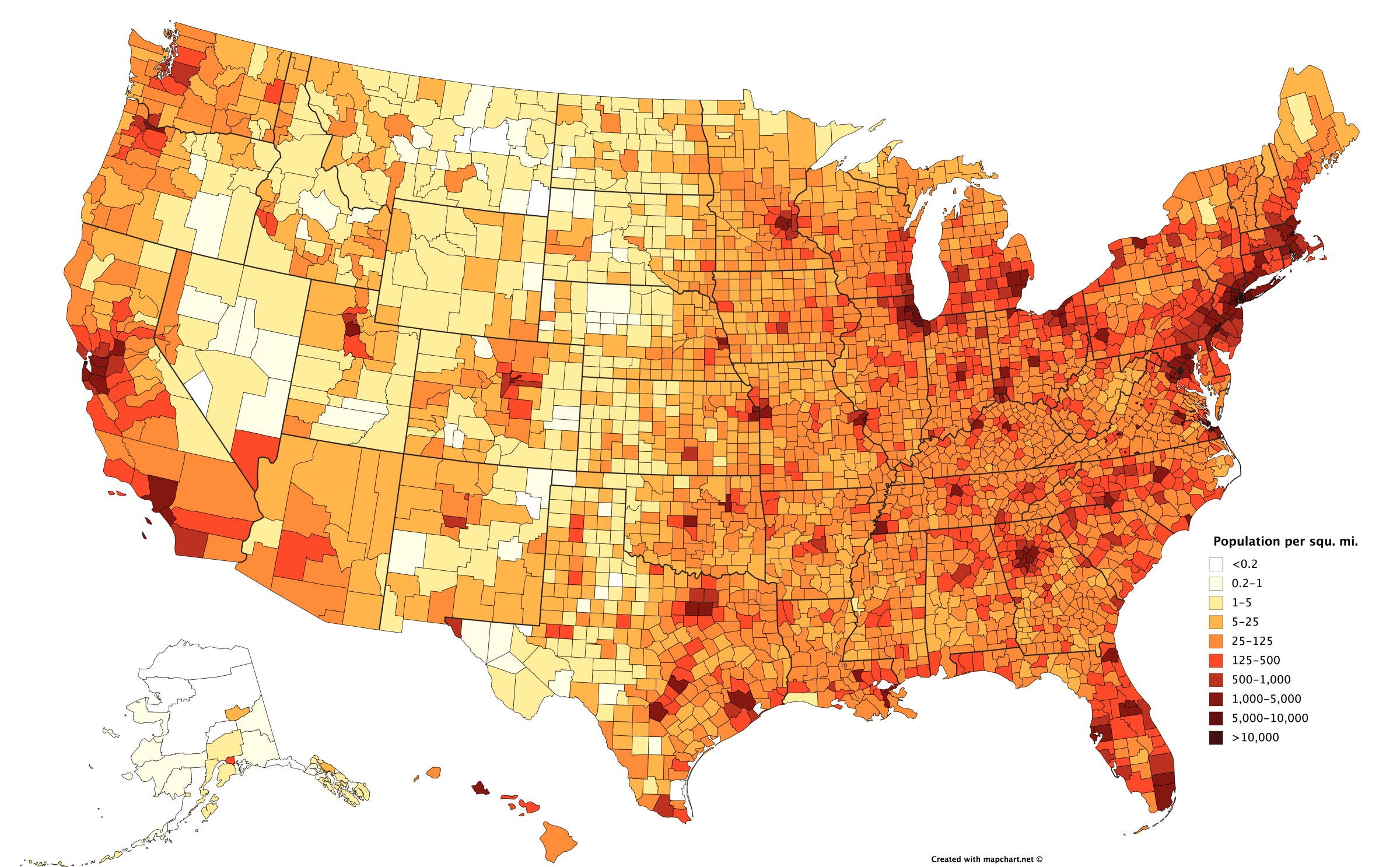
It isn't about the distances of 20, 50 or 3v3n 100 miles or such. It is what will the population density become once all of the cities around you empty out.
It is about how many people in total will be hitting the countryside in your direction. Not what your population per square mile IS...what will your population per square mile BECOME?
If for instance, you are in a rural area between Ashville and Winston Salem 20 miles off of I-40. You would be less safe than if you were 20 miles off of 1-20 between Abilene and Midland.
This would be so because there are fewer large cities in that general area to empty out and more people who are more self sufficient to begin with.
How many other self sufficient people stand between your BOL and the cities? Person at mile 20 takes out one. Property owner at mile 25, takes out another, mile 29, 35, 50, 100...pretty soon whatever was headed your way is down to a manageable trickle. Some might drown crossing a river with a bridge that was taken out. Some may meet with a pack of wolves, a grizzly, snakes. The more that start out, the more that get through.
Everybody on the big East coast cities and their uncles will head towards the Smokies/Appalachians. Same on the other coast. The most population dense regions of the country migrating like a swarm of locusts.
Trees are not the only thing that can hide you (trees can lose their foliage and can also burn leaving you unexpectedly exposed), Canyons, hills and architecture can as well. BOL1 Relies on two of those things. BOL2 will utilize three.
Of course, now we have better images and urban sprawl.
By connecting the dots you can see the corridors of "drift" that are most likely to happen.
One means of creating a good security plan is known as The C.A.R.V.E.R Matrix
Criticality, Accessibility, Recuperability, Vulnerability, Effect and Recognizability