AnarchistPrepper
Member
I don´t use a GPS. Depending on which kind of disaster strikes, GPS will be down after a few seconds to a few days.
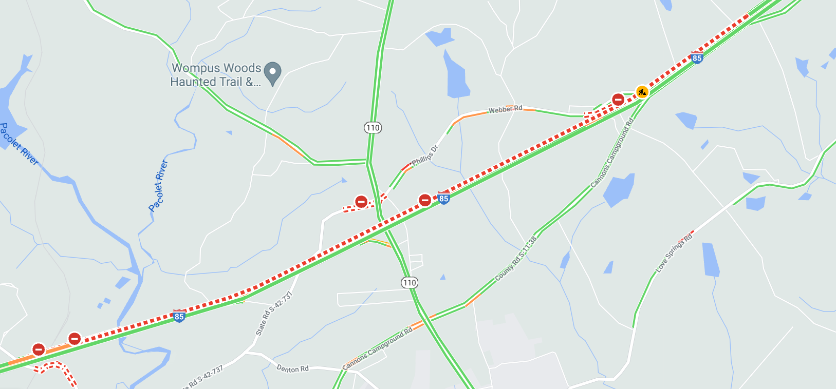
Some of you that don't understand what GPS can do simply can't comprehend what we are talking about. Paper maps can't tell me where recently closed roads and traffic jams are and the fastest way to get around them to avoid traffic. Google Maps (and it pains me to have to use Google anything) will give real time traffic information and suggest detours to save time. On nearly every trip up to North Carolina to see my daughter there will be a severe traffic jam or two or three and Google maps will warn me of it and tell me how to get around it. Coming back last week there was a 10 mile long logjam on I-85 at Gaffney with the southbound lanes at a complete standstill. I was able to drive around it before I got into the traffic jam.
This is what part of that stretch looks like RIGHT NOW on Google Maps:
Last time i was in Atlanta i got lost in 5 oclock traffic, the roads and signs down there are horrible!!Unfortunately I can't get to my daughter's house or my son's house without going through Atlanta. Going around is like an hour and a half detour. When my daughter was at Vanderbilt in Nashville we had to go through Atlanta to get there too. It's a friggin nightmare.
What about after SHTF?
Please move your GPS posts from vaccine thread to this one.
Had not thought about thatin regard to GPS - it's 100% controllable by the US gooberment - might not get to the actual SHTF kick-off before the US military goes coded >>> any attack on the US and friendlies will attempt to use active GPS for pinpoint target accuracy and navigation >> WW2 Pearl Harbor attack the Japs were listening to Sunday morning hula music heading in from the sea ....
wouldn't count on anything like GPS 100% - even in a domestic scuffle an administration like Biden's might find it advantageous to cut the civilian GPS along with communications & internet ....
Had not thought about that
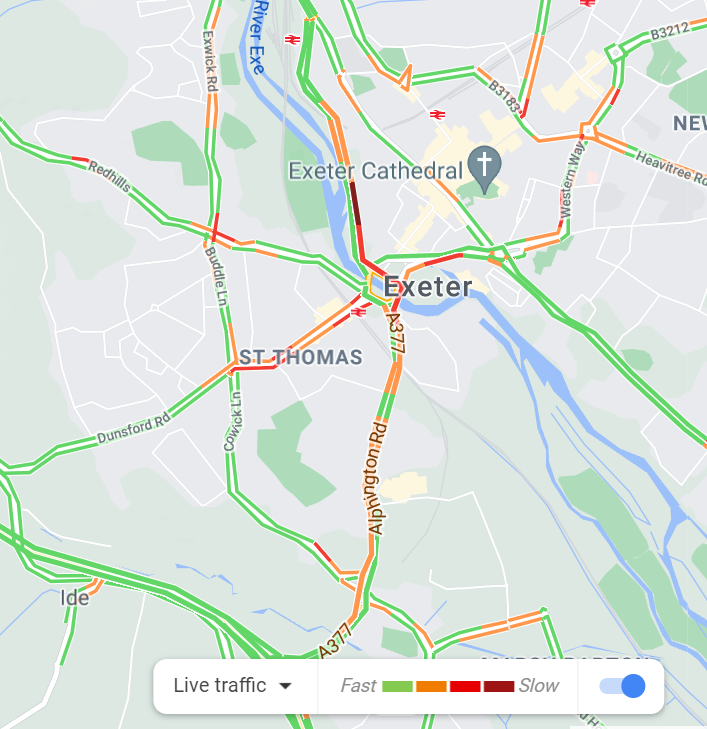
bigpaul, advance knowledge can't tell you a wreck happened one minute ago up ahead of you and has blocked the road. Google maps can tell you that. Sitting right here in the US behind my computer I can tell you where every traffic jam in Exeter is RIGHT NOW by looking at Google maps.as for road closures I probably know more road closures than any that appear on GPS systems and well in advance, knowing your area and regularly "patrolling" it gives better information than any GPS.
I dont use Google, many people over here dont trust it.bigpaul, advance knowledge can't tell you a wreck happened one minute ago up ahead of you and has blocked the road. Google maps can tell you that.
Yes it does. Every person using Google Maps to navigate is sending real time information to Google about where they are, how fast they are going and what direction they are traveling. When traffic stops, Google Maps knows it immediately. It even shows when a line of cars stops at a stop light.any mapping system dosent update for something that happens one minute ago.
Yes, required. And all pilots are expected to know how to chart the old ways. Not a skill they use much anymore but at least it’s still taught.never have got a strait answer in regard to planned & timed GPS coding and how they'd handle the existing civilian flights in-route to their destinations or emergency setdowns ....
only PAW type SHTF movie or TV show to situate an air flight was Jericho - can't imagine being on a commercial flight and being in that situation - no more GPS and/or ground control and probable plane systems outages - is there such a thing as a flight case and paper maps on any commercial flights anymore?
What’s not to trust with google? They pretty much admit they are going to invade your device and use and sell all your information. The trade off is they give you really great apps for free. It’s all there in that 10 thousand word user agreement that no one ever reads…. Sad, but true.I dont use Google, many people over here dont trust it.
any mapping system dosent update for something that happens one minute ago. in a rural area like this there are alternative routes, most wrecks over here happen on the motorways anyway.
Enter your email address to join: