- Joined
- Sep 7, 2013
- Messages
- 18,155
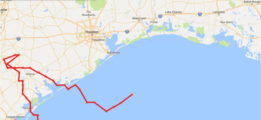
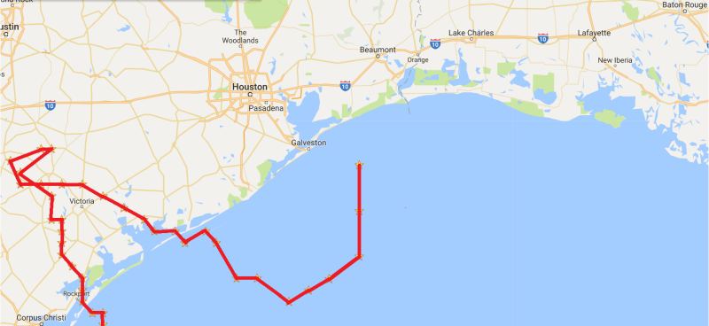
Harvey appears to be headed back into the Gulf of Mexico. It COULD potentially pick up strength and then hit Houston directly as a Category 1 Hurricane.
This thought is chilling. We're talking about a worst case scenario that is truly a "Disaster of Biblical Proportions." It would be bad enough if Houston weren't already soaked to the bone, but with the floodwaters already rising, and potentially millions of people stranded, a hurricane making landfall anywhere but east of Houston could make Katrina look like Harvey's baby sister.
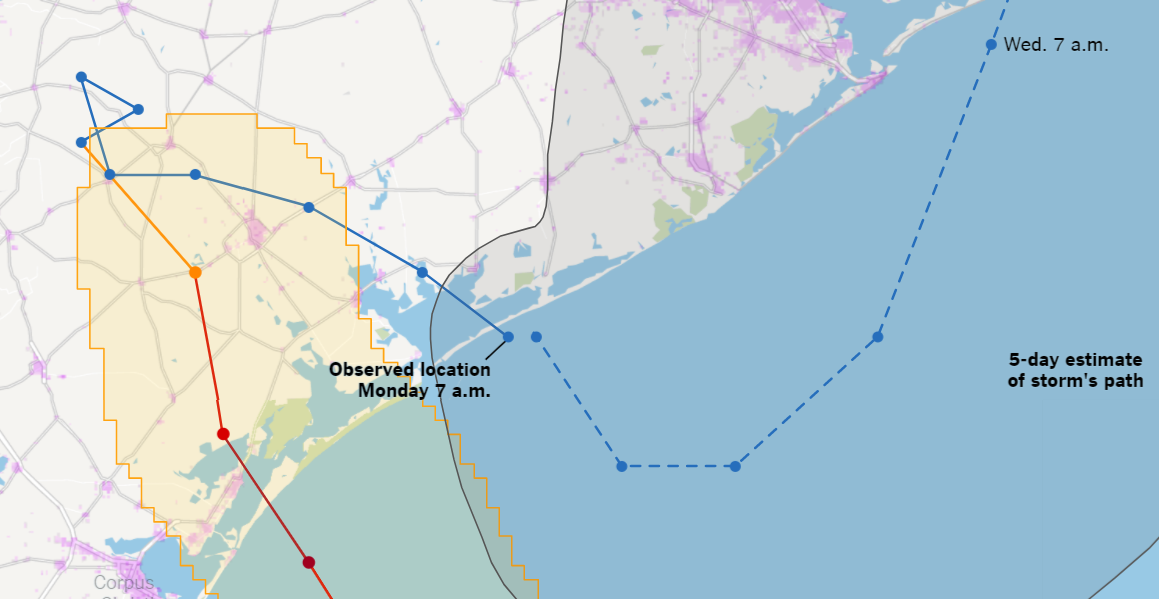
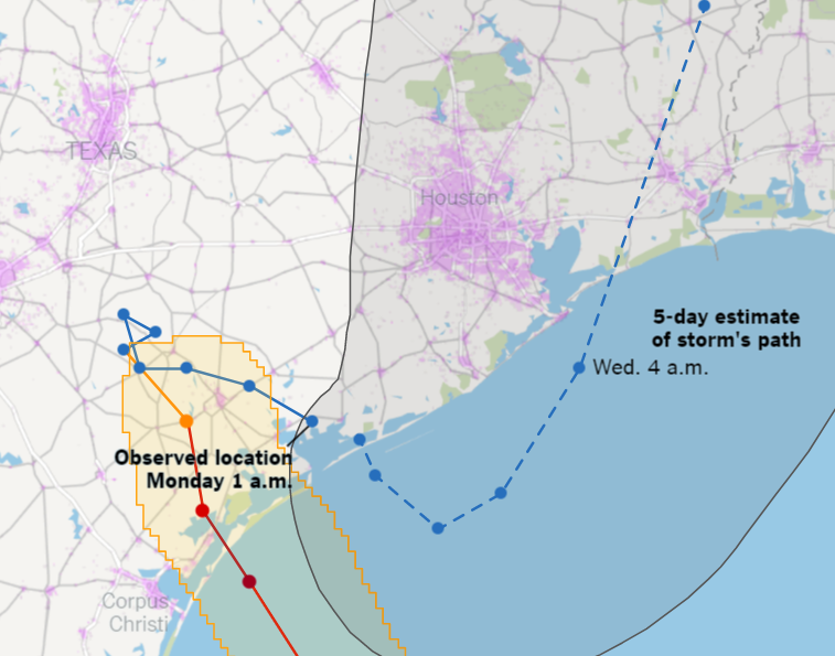
The absolute best case scenario, of course, is for it to just peter out. But if it remains a strong storm, then the best case scenario (for Houston anyhow) is what you see in the predicted storm track below. Where it stays south and east of Houston, and comes back ashore east of Houston...whether or not it makes landfall as a hurricane again.
This thought is chilling. We're talking about a worst case scenario that is truly a "Disaster of Biblical Proportions." It would be bad enough if Houston weren't already soaked to the bone, but with the floodwaters already rising, and potentially millions of people stranded, a hurricane making landfall anywhere but east of Houston could make Katrina look like Harvey's baby sister.
The absolute best case scenario, of course, is for it to just peter out. But if it remains a strong storm, then the best case scenario (for Houston anyhow) is what you see in the predicted storm track below. Where it stays south and east of Houston, and comes back ashore east of Houston...whether or not it makes landfall as a hurricane again.